GAMEofTHRNES MAP

Hills of Norvos

On this tab

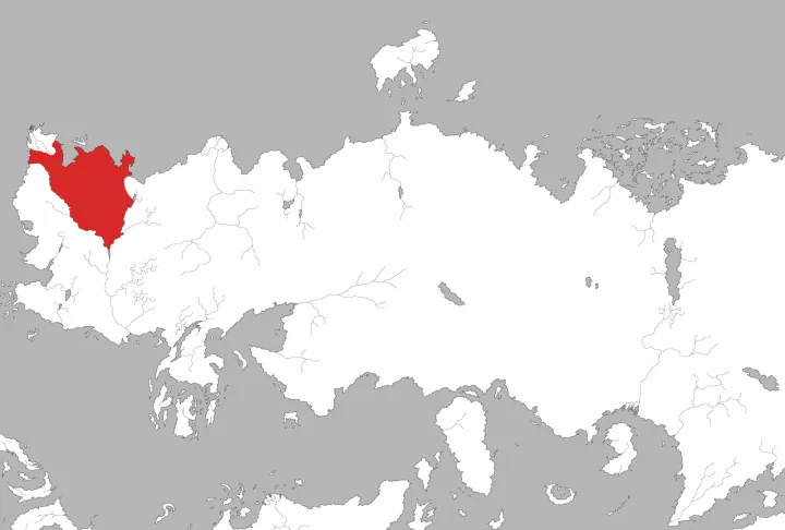
The Hills of Norvos are a broad range of high ground in northwestern Essos, running from Andalia to the Axe peninsula. The Free City of Norvos sits among them, and several of the rivers that feed the Rhoyne rise in these heights.

The physical world

Además, las carreteras valyrias conectan Pentos con Qohor, pasando por Norvos.

Geography · Danza de Dragones, Mapa Ciudades Libres.

Suggest an edit
Quote the sentence if you can, and write how it should read.Book and chapter, episode, or a link. Without a source we can't change it.Only to let you know if we apply it.

Gallery

  • Hills of Norvos — image 1
    Hills of NorvosHills of Norvos.png · gameofthrones.fandom.com · this wiki publishes under CC-BY-SA

On the map

On the map

Hills of NorvosBraavosLorathNorvosPentosVelvet Hills100 leaguesSee on the map
Its surroundings · 100 leagues · approximate position

What we are not sure about

  1. PositionWe worked it out

    The position was inferred from the label on the base map rather than from a symbol of its own: it marks the area, not the point.

Books and show

Where it appears

In the books (2)

  • The Lands of Ice and Fire
  • A Dance with Dragons

According to the Hielo y Fuego Wiki · Colinas de Norvos · 2026-07-30

Images remain the property of their authors and are published under the licence of the wiki that hosts them; each one links its page.

Where each datum comes from
Position
centroid of the hills bearing this name
English name
visual reading of the label
Spanish name
name from the published Spanish edition
Label on the base map
263
What was read
HILLS OF NORVOS
Features averaged into the centroid
2
Base map
atlas-known-world-2019.png · Adam Whitehead, Atlas of Ice and Fire

Entry written on .